")
Travelling to a tropical island surrounded by the ocean gives some people chills as they are worried about a tsunami.
Bali tsunami risk is real in theory, but to be fair, it is pretty slim in reality.
To understand how a tsunami works, and what warning system is in place in Bali, read our full guide for tsunamis in Bali. It will help you calm your worries and be aware, and prepared, for any potential emergencies.
What Is A Tsunami?
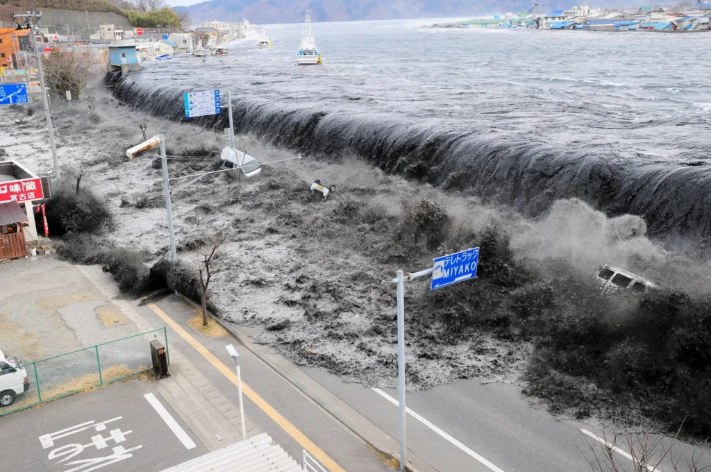
A tsunami is a series of powerful waves, spaced anywhere from 5 minutes to 2 hours apart, caused by sudden movement beneath the ocean floor, most often from an earthquake.
When the seabed shifts, it displaces huge volumes of water. Out in the deep ocean, you wouldn’t notice it. But when that energy hits the shallow coastline, it rises and moves inland with force.
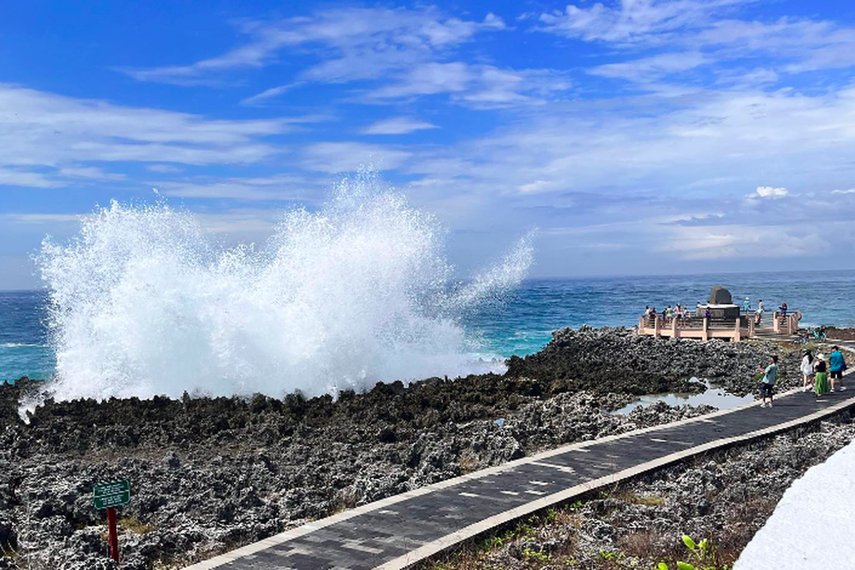
What does it look like? Before a tsunami strikes, there is usually a moment when the ocean pulls back, fishing boats may start to tilt, and reefs get exposed like during the low tide.
Something really important to remember about tsunamis is that tsunamis don’t usually arrive as one single dramatic wave. They can come in multiple surges. The first is not always the strongest and the longer the time between the waves is, the taller the next one can be.
How Common Are Tsunamis In Bali?
Geographically, tsunamis are possible in Bali as it sits along the Ring of Fire, right between the Indian and Pacific Ocean with the Sunda Trench lying South of the island, where the Indo-Australian Plate slides beneath the Eurasian Plate.
A fault line is right underwater next to the Southern shore of Bali.
But in reality, tsunamis are not common in Bali, unlike minor earthquakes.
According to the local officials for a tsunami to hit Bali’s East coastline, an earthquake of at least 8.5 magnitude should happen closer to the South Coast. Then, high-risk areas around Sanur and Benoa can see tsunami waves of 6 to 10 meters high.
Bali Tsunami Hazard Warning System & Siren System
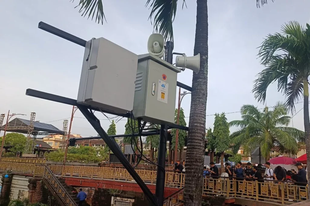
BMKG (Bali Meteorology, Climatology and Geophysics Agency) monitors seismic activity 24/7 posting updates on social media and their app.
After the 2004 earthquake, the Indonesian government has strengthened its early warning systems significantly.
It introduced the Tsunami Early Warning System in coastal areas like Kuta, Sanur, Benoa, Jimbaran, Jembrana, Seminyak, Nusa Dua, and keeps adding more under the Indonesia Disaster Resilience Initiatives Project (IDRIP).
Out in the ocean, there are special floating devices measuring water surface levels that give experts a heads up if big waves are coming.


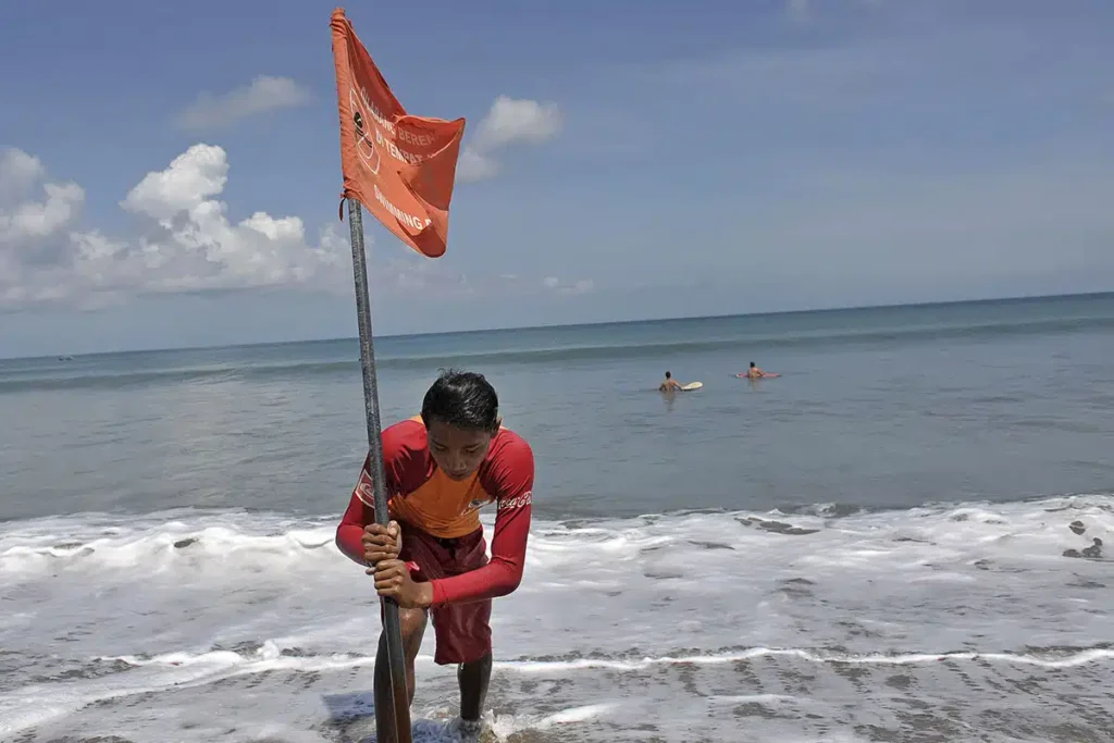
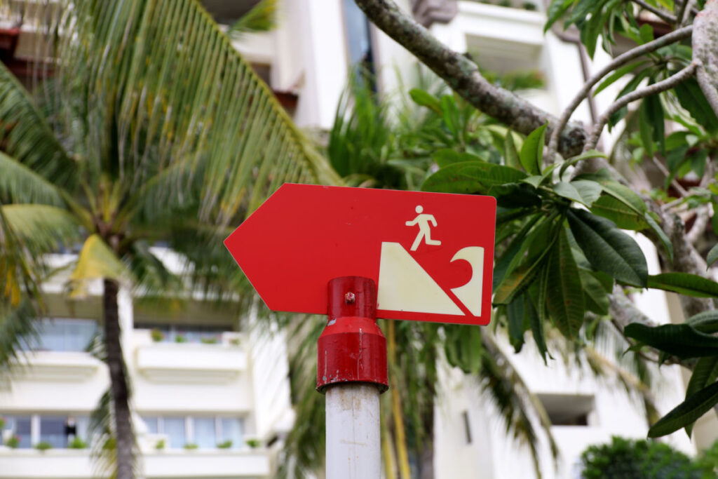
You’ll see green and orange “Tsunami Evacuation Route” signs in the villages near the beach, plus some of the most visited beaches have sirens installed.
Certain larger buildings in Kuta are designated as vertical evacuation points, for example, a tower with a statue on Kuta Beach, there is a special shelter in Seminyak, and a 12-meter-high Tsunami Temporary Evacuation Site (TES) in Serangan.
Big hotels in Bali are part of the Bali Hotels Association (BHA), which takes disaster mitigation very seriously and has tsunami protocols in place.
When Was The Last Indian Ocean Tsunami Near Bali?
Tsunamis struck Bali in 1977/1978 (although very few official records) and in 1994.
In 1977, Benoa beach seemed to be the affected area with locals reporting some beachfront hotels being damaged and a few extraordinarily big waves around Padang Padang.
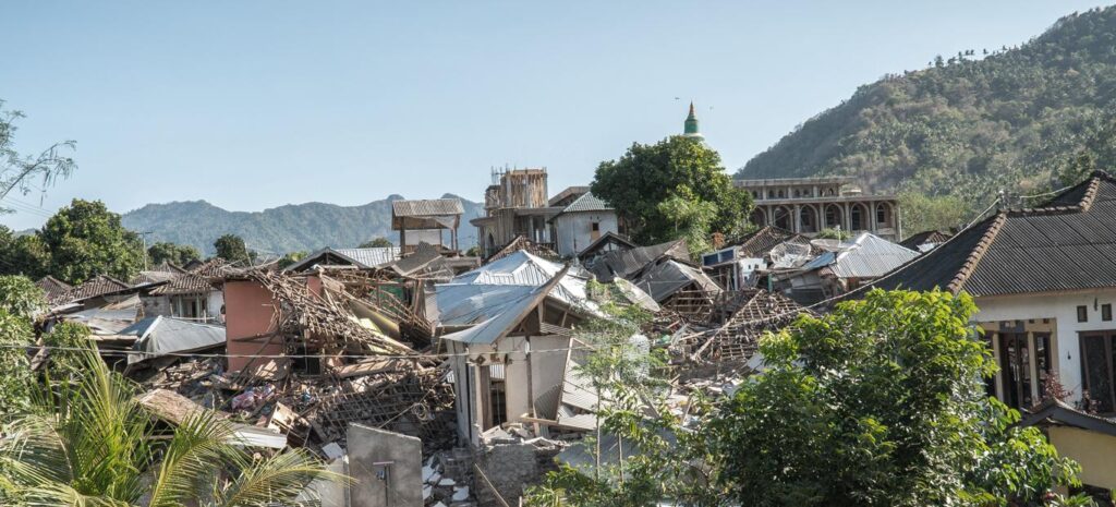
In 1994, A 7.8 magnitude earthquake on the East Coast of Java triggered 14-meter high waves. Around 200–250 people were killed there. As the tsunami source was somewhere between the islands, local authorities issued a warning in Bali, too.
But, in southern Bali and along the West Coast, 5-meter wave surges reached parts of Jembrana and areas along the South Coast, causing little to no damage and a small number of injuries.
Some flooding was reported along southern regions, particularly lower-lying areas, but the impact was localised. Local community and tourism went back to normal very quick.
More recently, earthquakes around Lombok in 2018 triggered temporary tsunami warnings for Bali. The tsunami waves never came, though, but locals and tourists were shaken!
High-Risk Areas & Tsunami-Safe Areas To Stay In Bali
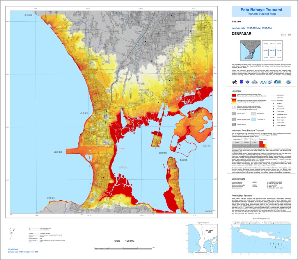
Bali is divided into special zones based on the tsunami risk the area has: yellow and red zones.
Red zones have the highest risk when a tsunami hits and everyone has to evacuate immediately after the sirens go off. High-risk areas in Bali are Legian beach, Kuta beach, Sanur, and Tanjung Benoa (very high risk as there is no higher ground to hide from the waves).
Yellow zones have a low risk of tsunami flooding and may not even be evacuated in case of a smaller tsunami.
There are also areas in Bali that have no tsunami risk at all, like Ubud and higher grounds around the mountains in Kintamani, Munduk, parts of Sidemen, and Uluwatu limestone cliffs.
Many beachfront hotels have evacuation plans. Some have rooftop safe zones. Staff are trained to direct guests quickly if needed. But if you want extra peace of mind, choose elevation.
What To Do If A Tsunami Hits Bali
If an earthquake or volcanic activity powerful enough to trigger a tsunami happens near Bali, the siren system will launch a 3-minute continuous signal.
Even if you didn’t hear the signal, but the earthquake shaking lasted for more than 20 seconds, consider the tsunami risks high.
That means, if you’re staying in the high-risk areas along the coast, you have to follow evacuation routes and leave the area within 15-20 minutes.
If you were on the boat, you have to head back to the shore immediately.
So if you’re located in the red zone, getting to the yellow zone is good enough. RPKD Radio at 92.6 FM will broadcast updates and important information, as well as BMKG official social media accounts.
3-story+ hotels, reinforced structures, and commercial buildings can serve as a safe temporary refuge, aka “vertical evacuation” if moving inland quickly isn’t possible, too.
Emergency numbers to save:
- Police: 110
- Ambulance: 118 or 119
- General Emergency: 112
FAQs
How Many People Died In The 2004 Bali Tsunami?
In 2004 there was one of the largest earthquakes and tsunamis in recorded history in the Indian Ocean but it didn’t affect Bali.
That tsunami hit hard Sri Lanka, the Maldives, parts of Thailand and India, and the Aceh region in Indonesia unfortunately taking many lives and causing serious damage.


How Safe Is Bali From Natural Disasters?
Bali is geographically in a region with higher risks of earthquakes, volcanic eruptions, and tsunamis, but so far, the worst natural disasters have left the island alone.
Will Bali Earthquake Trigger A Tsunami Flooding?
Bali earthquakes can trigger a tsunami only under certain circumstances and it has to be a very powerful earthquake.
The majority of the earthquakes near Bali are too weak, shallow or with epicentres too far away to trigger a tsunami wave.
However, climate change, rising of the global sea level, and active seismic activity in the area can certainly cause a larger earthquake and a tsunami.
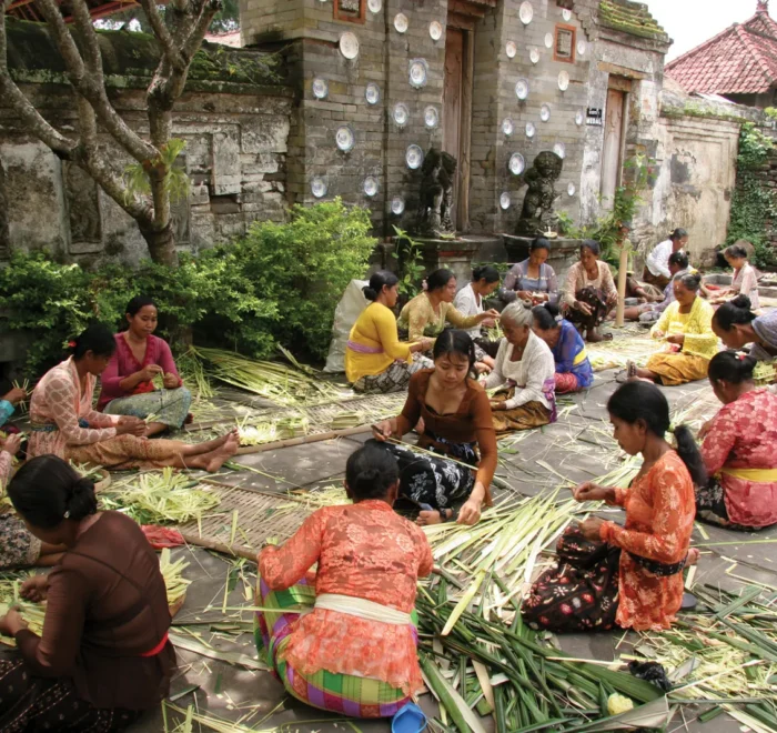
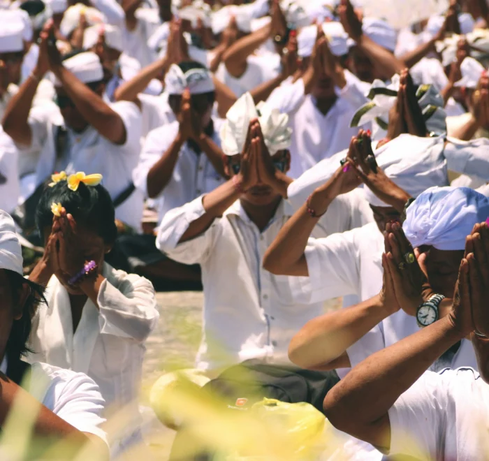
So while tsunamis aren’t common, community preparedness and awareness are super important, as well as having proper travel insurance while planning your Bali holiday.
Final Thoughts On Tsunamis In Bali
While Bali’s location in the middle of the Indian Ocean and close to tectonic plates moving, the real risk of earthquakes and tsunami does exist.
However, history shows that there were no serious tsunami in Bali to disrupt your vacation in the past years. With the information in this simple guide, you are more than prepared to what can happen and can plan your trip accordingly!